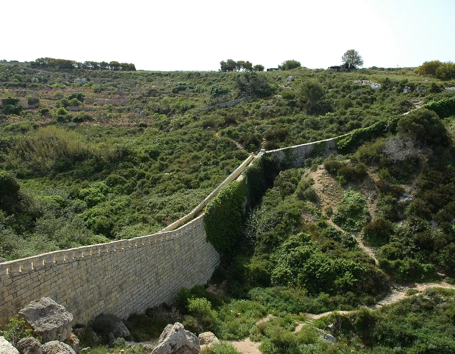
A wall runs across Malta from Fomm ir-Riħ on the west coast to Madliena in the east.
It follows a natural ridge, it is about twelve kilometres long, and most people drive under it without noticing.
What the Victoria Lines were for
The British built them in the late nineteenth century along the Great Fault, the escarpment that cuts the island in two.
The idea was to hold a line across the north and keep an invading force away from the harbours.
They were named for Queen Victoria’s diamond jubilee in 1897, by which time the work was largely done.
The line was never fought over. By the 1900s artillery had outgrown it and the army had moved on.
What is still there
Long stretches of the wall, gun positions, a few forts and several small bridges.
Some sections are in good order and some have fallen away into the fields below.
Fort Madliena at the eastern end and Fort Bingemma at the western end are the two anchors. Fort Mosta sits in the middle and is still military ground.
The Dwejra Lines and the searchlight positions above Mosta are the easiest bits to find.
Walking the line
You can follow much of the line on foot and it is the best long walk on the island.
The ground is rough, there is no shade, and parts run through private land. It is not a marked trail and there is no signage to follow.
Do it between November and April. In summer the exposed ridge is punishing by nine in the morning.
End to end takes six to eight hours at a walking pace, with route-finding. Most people split it into two or three sections.
Shorter sections
Bingemma to Mosta is the most complete stretch of wall and the easiest to follow.
Ta’ Falka to Targa Gap gives you the ridge with the whole north of the island below it.
Buses reach Mosta, Mgarr and Naxxar. Getting back from where you finished is the part to plan first.
What to take
Boots. The ground is loose limestone and there are drops with nothing between you and them.
More water than you think, and a paper map or an offline one. Signal drops in the valleys.
Go with someone. Parts of the line are far enough from a road that a turned ankle becomes a problem.
If you only want to see it
Drive to the stretch above Mosta or to Bingemma.
Both give you the wall running along the ridge and the whole north of the island spread out underneath. Ten minutes from the car.